Precision Obsession: When Chasing Millimetres Becomes a Costly Distraction for Australian Industry
There is a particular kind of conversation that recurs at geospatial conferences across Australia. A vendor demonstrates centimetre-level positioning capability. The audience leans forward. Questions follow not about whether such precision is necessary, but about how quickly it can be deployed. The assumption embedded in that exchange — that more accuracy is always better — has quietly become one of the industry's most expensive orthodoxies.
The pursuit of hyper-precision GPS is not, in itself, irrational. For specific applications — machine-guided surgery, autonomous vehicle navigation in dense urban corridors, structural deformation monitoring on critical infrastructure — the difference between a five-centimetre fix and a two-centimetre fix can carry genuine consequence. But Australia's geospatial sector has progressively extended that logic far beyond the domains where it legitimately applies, and the financial and operational costs of doing so are beginning to attract serious scrutiny.
The Precision Premium and Who Actually Pays It
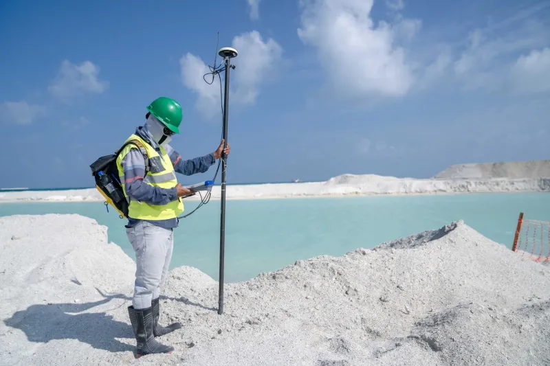
Deploying Real-Time Kinematic (RTK) or Precise Point Positioning (PPP) infrastructure is not cheap. Base station networks, correction data subscriptions, compatible receivers, and the technical expertise required to validate outputs represent a substantial capital and ongoing operational commitment. For large mining operations or major infrastructure contractors, those costs can be absorbed within project budgets of sufficient scale. For mid-tier construction firms, regional councils, or agricultural cooperatives operating on thin margins, the calculus is considerably less comfortable.
Dr. Fiona Marchetti, a geospatial consultant who has worked across local government projects in Victoria and New South Wales, describes a pattern she encounters regularly. "Councils will come to us having been told they need sub-centimetre accuracy for asset management work — mapping footpaths, locating drainage infrastructure, recording street furniture," she says. "When we actually interrogate the downstream use of that data, it almost never justifies the investment. A thirty-centimetre horizontal accuracy is entirely sufficient for the decisions being made, and they could achieve that with far simpler, far cheaper equipment."
This mismatch between specified accuracy and operational necessity is not a minor inefficiency. It shapes procurement decisions, inflates project scopes, and creates technical debt when organisations invest in platforms and workflows calibrated to precision tolerances they will never meaningfully exploit.
The Specification Creep Problem
Part of the issue is structural. Accuracy requirements in project specifications have a tendency to migrate upward over successive procurement cycles, not because operational needs have changed, but because the previous specification was met without incident and the natural instinct is to tighten it further. This phenomenon — sometimes called specification creep — means that the accuracy bar rises continuously, even when there is no evidence that the previous standard was causing failures.
Mark Ogilvy, a senior surveyor with experience across Queensland infrastructure projects, identifies a related dynamic in tendering processes. "When a specification calls for five-centimetre accuracy and you can demonstrate two-centimetre capability, you win the tender," he explains. "So everyone pushes toward higher precision not because the client genuinely needs it, but because the competitive environment rewards it. The client ends up paying for accuracy they don't use, and the industry reinforces the expectation."
The problem compounds when accuracy requirements are written into contracts by procurement officers or project managers without deep geospatial expertise. Figures are borrowed from previous contracts, inflated slightly as a precaution, and embedded into documentation that then shapes equipment selection, field methodology, and quality assurance protocols — all calibrated to a standard that was never rigorously derived from operational need.
When 'Good Enough' Is Genuinely Good Enough
The phrase 'fit for purpose' is familiar to anyone who has worked in quality management, but it has struggled to gain traction in geospatial discourse, where the culture of precision is deeply embedded. Yet the concept is directly applicable and, in many Australian contexts, urgently needed.
Consider urban planning applications. Analysts working with population movement data, land use classification, or transport network modelling are typically operating at spatial resolutions measured in metres or tens of metres. The positional accuracy of individual data points within those datasets is rarely the limiting factor in analytical quality — data completeness, temporal currency, and classification consistency are far more consequential variables. Investing in centimetre-level GPS infrastructure for data collection in these contexts delivers no meaningful improvement to the outputs that planners actually use.
Similarly, in many precision agriculture applications, the agronomic benefit of sub-centimetre guidance over five-centimetre guidance is, for most crops and most farming systems, negligible. The yield and input-efficiency gains from variable-rate application and auto-steer technology are largely captured at guidance accuracies that mid-range GNSS receivers have been capable of delivering for years. Yet the marketing of newer, more precise systems continues to drive upgrade cycles that may not be economically justified on the majority of Australian farms.
The Opportunity Cost Nobody Calculates
Perhaps the most underappreciated dimension of the precision obsession is what it displaces. Every dollar directed toward achieving centimetre-level accuracy in a context that doesn't require it is a dollar not spent on data coverage, data integration, or analytical capability — investments that would, in many cases, deliver substantially greater operational value.
Australia's geospatial data landscape has well-documented coverage gaps, particularly across regional and remote areas. The irony is that organisations in those areas are sometimes encouraged to invest in high-precision positioning infrastructure while simultaneously operating from base maps that are years out of date, incomplete, or geometrically inconsistent. The precision of a single point fix means very little when the reference data against which it is interpreted is unreliable.
Dr. Marchetti makes the point directly. "I'd rather have good fifty-centimetre data across an entire local government area than perfect two-centimetre data across thirty per cent of it. Coverage gaps cause real operational problems. The difference between two centimetres and five centimetres, in most of the work I see, causes none."
Recalibrating the Industry Conversation
None of this is an argument against precision positioning. RTK, PPP, and the broader infrastructure of high-accuracy GNSS have transformed Australian industries in ways that are genuinely significant and well-documented. The argument is narrower: that the industry has allowed precision to become an end in itself, detached from the operational contexts that should define what accuracy is actually required.
A more disciplined approach would begin with a rigorous articulation of the decision or action that geospatial data is intended to support, derive accuracy requirements from that purpose, and then select the technology capable of meeting — not exceeding — that requirement at the lowest viable cost. This is not a novel methodology. It is basic systems engineering applied to geospatial procurement, and its absence from many Australian projects is conspicuous.
The geospatial sector has an opportunity to lead that recalibration. Professional bodies, research institutions, and practitioners with the standing to challenge prevailing assumptions are well-placed to reframe the conversation — not as a retreat from technical excellence, but as a more sophisticated understanding of what excellence actually means in context.
Chasing the last millimetre is sometimes exactly the right thing to do. The discipline lies in knowing when it isn't.