Mapped Before You Move: How Predictive Geospatial AI Is Redrawing Australia's Property Landscape
There is a particular kind of anxiety that accompanies the search for a first home in Australia. Rising interest rates, constrained supply, and the sheer opacity of auction markets have long made property acquisition feel like navigating without a compass. Yet for a growing cohort of institutional investors and technology-equipped agencies, the compass not only exists — it is extraordinarily precise. Predictive geospatial artificial intelligence is quietly transforming how Australian real estate is valued, traded, and ultimately accessed, and the consequences for ordinary buyers are only beginning to be understood.
The Architecture of Prediction
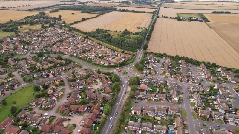
At the foundation of these systems lies an increasingly rich tapestry of location data. Satellite imagery captured at regular intervals reveals subtle but telling signals: the spread of tree canopy, the density of parked vehicles, the pace of rooftop solar installation, the gradual replacement of fibrous cement cladding with rendered facades. When layered against GPS-derived mobility datasets — anonymised movement patterns drawn from smartphone telemetry — these images begin to tell a story about where people are choosing to spend their time, and crucially, where they are beginning to spend it for the first time.
Historical transaction records, zoning overlays, proximity to transport infrastructure, school catchment boundaries, and flood-risk mapping derived from LiDAR elevation models all feed into models that can now generate suburb-level and even street-level forecasts of capital growth, rental yield trajectories, and gentrification probability. The computational machinery behind these forecasts is no longer confined to research laboratories. Several Australian proptech firms and at least two major commercial banks have integrated variants of this capability into their internal valuation and lending risk tools.
Gentrification at the Coordinate Level
Perhaps the most consequential application of predictive geospatial modelling is its capacity to identify gentrification before it registers in median price statistics. Traditional indicators — café density, planning applications, demographic survey data — are inherently lagging. They describe change that has already occurred. Satellite-derived analysis of building renovation rates, combined with GPS mobility data showing an influx of visitors from higher-income postcodes, can identify the leading edge of neighbourhood transformation months or even years before prices begin to move.
For institutional investors with access to these tools, this temporal advantage is commercially significant. For the renters and long-term residents already living in those neighbourhoods, it can translate directly into displacement. The algorithm, in this sense, does not merely observe gentrification — it may accelerate it by directing capital toward precisely those locations identified as undervalued and socially transitioning.
This dynamic has been observed in comparable international markets, but Australia's particular urban geography — with its pronounced inner-ring versus outer-ring spatial inequality in cities like Melbourne, Sydney, and Brisbane — gives the phenomenon a local intensity. The geospatial data that powers these models is not neutral. It encodes existing patterns of advantage and disadvantage, and when fed into optimisation engines designed to maximise financial return, it tends to reinforce them.
First-Home Buyers in an Asymmetric Market
The information asymmetry created by predictive geospatial AI presents a structural challenge for first-home buyers operating without institutional resources. A buyer relying on publicly available median price data and personal observation is, in effect, reading yesterday's newspaper. Meanwhile, an investor backed by a platform with access to satellite change-detection analytics and aggregated GPS foot-traffic data is reading a forecast.
Some Australian proptech platforms have attempted to address this imbalance by offering consumer-facing versions of geospatial analytics — suburb heat maps, growth probability scores, infrastructure pipeline overlays. These tools represent a genuine democratisation of spatial intelligence in their most basic form. However, the depth and timeliness of data available to retail users typically lags behind what institutional actors can access through proprietary feeds and bespoke modelling arrangements.
The question of whether geospatial AI ultimately widens or narrows the informational gap in Australian property markets remains genuinely open. The technology is capable of both outcomes. Freely available, well-designed tools could give first-home buyers meaningful insight into neighbourhood trajectories. Restricted to those who can afford premium access, the same technology becomes another mechanism for concentrating wealth among those who already hold it.
Satellite Imagery and the Valuation of Place
Beyond transaction prediction, geospatial AI is also reshaping how individual properties are valued. Automated valuation models have existed for over a decade, but their integration with real-time satellite and aerial imagery represents a qualitative shift. A model that can assess not just a property's recorded attributes but the current condition of its street, the proximity of visible amenity changes, and the trajectory of its immediate surroundings is producing valuations with a different epistemological character — one grounded in observed spatial reality rather than historical analogy alone.
For lenders, this capability has significant appeal. For property owners in areas experiencing rapid environmental change — whether through urban development, climate-related risk exposure, or infrastructure investment — it introduces a new form of vulnerability. A home in a suburb flagged by satellite analysis as flood-adjacent or bushfire-proximate may find its algorithmic valuation diverging sharply from owner expectations, with direct implications for refinancing capacity and insurance eligibility.
Governance and the Limits of Spatial Foresight
The regulatory framework governing the use of geospatial data in Australian property markets has not kept pace with the technology's capabilities. Privacy legislation addresses the collection and handling of personal location data, but the aggregated, anonymised datasets that power predictive property models sit in a less clearly defined space. The commercial exploitation of GPS mobility data for property market forecasting does not require individual identification to have significant population-level effects.
Planning authorities and housing policy bodies are beginning to grapple with these questions, but substantive regulatory engagement remains limited. The risk is that governance frameworks designed for an era of static maps and periodic surveys will prove inadequate for a market increasingly shaped by continuous, satellite-fed spatial intelligence.
Monash University's geospatial research community has a role to play in this conversation — not merely as technical developers of these systems, but as critical analysts of their social and spatial consequences. Understanding how predictive algorithms interact with existing patterns of urban inequality, and designing tools that distribute spatial intelligence more equitably, are research imperatives as pressing as the engineering challenges they accompany.
Reading the Map Critically
Predictive geospatial AI is not inherently a force for harm in Australian property markets. Applied thoughtfully, with appropriate data governance and equitable access, it holds genuine promise for reducing the information deficits that have long disadvantaged ordinary buyers. The satellite can see what the street-level observer cannot. That visibility, properly directed, could support more informed decisions by households, more responsive planning by governments, and more efficient allocation of housing supply.
But the technology's current trajectory — concentrated in institutional hands, oriented toward return maximisation, and largely ungoverned in its property market applications — warrants careful scrutiny. The algorithm may well know your address before you do. The more important question is whose interests it is serving when it does.