Building to the Millimetre: How RTK Positioning Is Reshaping Australia's Construction Landscape
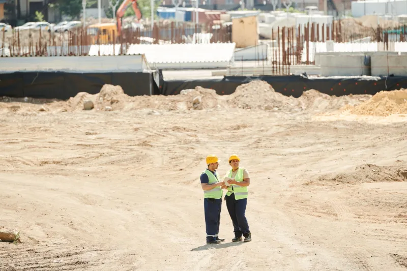
For most of the twentieth century, the acceptable margin of error on an Australian construction site was measured in centimetres — sometimes tens of them. Surveyors planted pegs, engineers read levels, and projects were reconciled to tolerances that, while functional, left considerable room for rework, material waste, and costly disputes over alignment. That era is ending. Across the country's most ambitious infrastructure programmes, a new standard is emerging: one measured not in centimetres, but in millimetres — and enforced not by the human eye, but by satellite.
Real-Time Kinematic (RTK) positioning, which pairs satellite signals with ground-based correction data to achieve horizontal accuracies of one to two centimetres and vertical accuracies approaching five millimetres, is no longer a technology reserved for specialist geodetic surveys. It has migrated from the surveyor's tripod to the cab of a grader, the blade of a bulldozer, and the control panel of a concrete paver. On the most technically advanced job sites operating today, the machine itself knows — to sub-centimetre resolution — exactly where it is and exactly where it needs to go.
From Pegs to Positioning Engines
The traditional model of construction survey involved a licensed surveyor establishing control points across a site, from which foremen and operators would work outward using optical instruments and physical markers. The process was iterative, labour-intensive, and vulnerable to marker disturbance — a single misplaced peg could propagate errors across hundreds of metres of earthworks before anyone noticed.
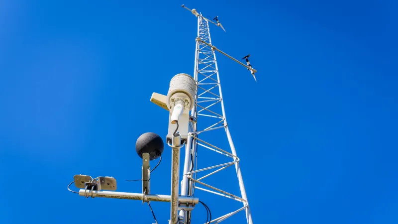
RTK-based machine control systems eliminate much of this exposure. A receiver mounted on a grader blade communicates continuously with a base station or a network of reference stations — in Australia's case, often leveraging Geoscience Australia's CORS (Continuously Operating Reference Stations) network — and feeds real-time positional data directly to the machine's guidance system. The operator is presented with a digital terrain model and a live indication of cut or fill required at each point. The machine does the arithmetic.
The implications for productivity are significant. Industry practitioners report reductions in earthmoving passes of between fifteen and thirty per cent on large-scale civil projects, with corresponding reductions in fuel consumption and equipment wear. On projects where ground conditions are variable and rework is expensive — road bases across Western Australia's Pilbara, for instance, or flood-prone corridors in South-East Queensland — those savings compound rapidly.
The Competitive Calculus
Australia's construction sector is fiercely price-competitive, and margins on major civil contracts are frequently thin enough that a percentage point of waste reduction can determine project viability. This has accelerated RTK adoption faster than many observers anticipated.
Contractors bidding on state and federal infrastructure projects — the Victorian Big Build, the Bruce Highway Upgrade Programme, Perth's METRONET rail expansion — are increasingly expected to demonstrate geospatial capability as a condition of tender. Some procurement frameworks now explicitly reference machine control and digital survey deliverables as technical requirements, not optional enhancements.
For firms that invested early in RTK infrastructure, this represents a meaningful barrier to entry for less-equipped competitors. The capital outlay — base stations, rover units, machine control hardware, and the software licences to run digital terrain models — is not trivial. However, practitioners consistently report that payback periods on well-utilised equipment fall within two to four years on active civil programmes, a timeline that has become commercially compelling as project pipelines have lengthened under sustained infrastructure spending.
Safety as a Positioning Problem
Beyond efficiency, there is a safety dimension to precision positioning that deserves more attention than it typically receives in commercial discussions. Construction sites rank among Australia's most hazardous workplaces, and a significant proportion of serious incidents involve plant operating in proximity to buried services, structural elements, or other workers.
Geospatial technology is beginning to address this directly. Several major contractors operating in urban environments — where the density of underground utilities creates constant excavation risk — have integrated RTK positioning with as-built utility databases, enabling excavator operators to receive proximity alerts when their bucket approaches a registered service corridor. The system does not replace physical service location, but it adds a spatially-aware layer of verification that conventional methods cannot provide.
Similarly, on large earthmoving sites, RTK-equipped plant can be tracked in real time, enabling supervisors to monitor machine positions against exclusion zones and respond to incursions before they become incidents. The positioning data generated in this context also creates a defensible audit trail — increasingly valuable in an environment of heightened workplace safety scrutiny.
Technical Challenges That Remain
RTK positioning is not without its limitations, and the construction industry is encountering several of them as adoption deepens. Urban canyons — the dense vertical environments of Sydney's CBD or Melbourne's Docklands — create multipath interference that degrades satellite signal quality and can introduce positioning errors at precisely the moments when accuracy is most critical. Tall cranes, steel-framed structures under construction, and adjacent buildings all contribute to signal obstruction.
Practitioners working in these environments are increasingly supplementing RTK with inertial measurement units (IMUs) and terrestrial total station networks, creating hybrid positioning solutions that maintain accuracy even when satellite geometry is compromised. The integration of these technologies requires specialist expertise that remains in short supply across the industry, and the training pipeline for geospatial-capable construction professionals is a concern that industry bodies have begun to raise with vocational education providers.
Data management presents a parallel challenge. RTK-equipped sites generate positional records at rates that can exceed thousands of observations per minute across a fleet of machines. Storing, processing, and deriving actionable intelligence from this volume of data requires investment in software infrastructure that some mid-tier contractors have found difficult to justify or resource.
What Comes Next
The trajectory of precision positioning in Australian construction points toward further integration rather than incremental improvement. The sector is watching closely as multi-constellation receivers — capable of drawing on GPS, GLONASS, Galileo, and BeiDou simultaneously — become standard equipment, improving both accuracy and availability in challenging signal environments.
There is also growing interest in the application of RTK-derived datasets beyond the construction phase itself. As-built positional records captured at millimetre resolution during construction represent an asset of considerable long-term value: a spatial baseline against which future maintenance surveys, structural monitoring programmes, and infrastructure renewal decisions can be referenced. Several state road authorities are already exploring frameworks for capturing and retaining this data as part of project handover requirements.
For Monash University's geospatial research community, the construction sector's engagement with precision positioning raises a series of productive questions. How should positioning data standards be defined to ensure interoperability across project phases and asset owners? What correction infrastructure investments would most benefit Australian contractors operating in regions currently underserved by reference station networks? And how can the academic and vocational education systems respond more effectively to the industry's evident and growing demand for geospatially literate practitioners?
The millimetre has become the new benchmark. The industry that learns to build to it consistently — and to extract lasting value from the data that precision generates — will define Australian construction for the decades ahead.