Reading Rain in the Signal: How GPS Ground Networks Are Rewriting Australia's Flood Forecast Playbook
When floodwaters tore through the Hawkesbury-Nepean Valley in March 2021, the speed and scale of inundation caught many residents and emergency managers off guard. Weather radar had detected rainfall, but the sheer volume of atmospheric moisture feeding the event — the invisible precursor that made that flooding so catastrophic — had not been adequately quantified in advance. It was, in the language of meteorologists, a forecasting gap. What fewer people knew at the time was that a network of ground-based GPS receivers scattered across New South Wales had, in effect, been silently recording exactly the kind of tropospheric signal that could have provided much earlier warning. The data existed. The interpretive framework to act on it was still catching up.
This is the central tension at the heart of GPS meteorology in Australia: an increasingly mature observational capability sitting within a forecasting system that has not yet fully integrated it.
The Physics of a Wet Signal
To understand why GPS receivers can function as weather instruments, it helps to appreciate what happens to a positioning signal as it travels from satellite to Earth. The troposphere — the lowest layer of the atmosphere, where all weather occurs — slows and bends that signal. The degree of delay is not random. It is directly related to the density and moisture content of the air through which the signal passes.
Satellite geodesists have long treated this delay as an unwanted error to be corrected. GPS meteorologists, by contrast, treat it as the measurement itself. By precisely calculating the excess delay across a network of ground receivers — a technique known as GPS precipitable water vapour (GPS-PWV) retrieval — researchers can derive a real-time, vertically integrated measure of atmospheric moisture with remarkable accuracy.
The advantage over traditional radiosonde balloon launches, which remain the backbone of upper-atmosphere humidity measurement in Australia, is substantial. Balloons ascend twice daily from a limited number of sites. A GPS reference network, by contrast, samples continuously, at every receiver location, across all weather conditions. Rain, cloud, and darkness impose no constraint on the measurement.
Australia's Reference Network as an Unintended Weather Asset
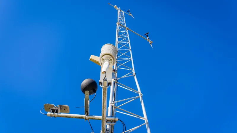
Australia operates one of the most extensive continuously operating GNSS reference station networks in the Southern Hemisphere. Geoscience Australia's CORS network, supplemented by state-level infrastructure and the growing density of commercial reference stations supporting precision agriculture and surveying, now provides coverage across much of the populated eastern seaboard and parts of the interior.
This infrastructure was built primarily to support geodetic positioning, cadastral surveying, and machine guidance applications. Its utility as a meteorological asset has emerged as something of a productive accident — though researchers at institutions including Monash University have been working deliberately for years to formalise that utility.
The core technical challenge lies in separating the tropospheric delay attributable to water vapour from the component caused by dry air pressure, and then converting that signal into a quantity the Bureau of Meteorology can assimilate into its numerical weather prediction models. The mathematics are well understood. The operational pipeline — the automated, near-real-time processing chain that moves GPS-PWV estimates from receiver networks into operational forecasting — is where Australian capability has lagged behind leading programmes in Europe, the United States, and Japan.
Case Studies in Near-Miss Prediction
Researchers examining the atmospheric conditions preceding Australia's most damaging recent flood events have identified a consistent pattern. In the hours and days before peak rainfall, GPS-PWV values across regional receiver networks show pronounced and anomalous increases — moisture loading that precedes the convective or frontal systems that ultimately deliver the rain.
Analysis of the February 2022 South-East Queensland and Northern New South Wales floods — among the costliest natural disasters in Australian history — has shown that GPS stations across the region recorded exceptional precipitable water vapour values more than 36 hours before emergency services declared major flood levels on key river systems. Comparable pre-event signatures have been identified in retrospective studies of the 2011 Brisbane floods and the 2016 Latrobe Valley inundation events.
The 36-to-48-hour lead time is significant. It is the window within which evacuation orders become logistically viable, within which road closures and emergency pre-positioning can occur without the chaos of last-minute response. Traditional radar systems detect precipitation as it falls. GPS meteorology, at its most effective, detects the atmospheric conditions that will produce that precipitation before the first drop forms.
Integration Challenges and the Bureau of Meteorology's Position
The Bureau of Meteorology has been engaged with GPS-PWV research for over a decade, and its scientists have contributed to peer-reviewed work establishing the technique's validity in the Australian context. The more difficult question has been operational integration — specifically, how to ingest GPS-derived moisture estimates into the Australian Community Climate and Earth-System Simulator (ACCESS), the Bureau's primary numerical weather prediction platform.
Data assimilation is technically demanding. GPS-PWV observations must be quality-controlled, bias-corrected, and formatted to a standard the model can use, all within a processing window of minutes if the data is to have forecast value. International programmes, particularly those run by EUMETNET in Europe, have demonstrated that this pipeline can be made to work reliably at scale. Australia has the receiver infrastructure. The remaining work is largely one of software engineering, institutional coordination, and sustained funding commitment.
Researchers involved in this space note that progress has accelerated in the wake of recent flood disasters, with both federal government attention and research council funding flowing toward climate adaptation tools. The 2022 floods, in particular, appear to have shifted the conversation from scientific curiosity to operational urgency.
The Broader Geospatial Opportunity
What makes GPS meteorology particularly compelling from a geospatial science perspective is that it transforms existing positioning infrastructure into a dual-purpose environmental sensing network at relatively low marginal cost. Every reference station already installed for survey and navigation purposes becomes a potential weather observation node. As receiver density increases — driven by precision agriculture, autonomous vehicle guidance, and smart city applications — the meteorological network grows in parallel, without additional capital expenditure.
This convergence of positioning and environmental sensing is characteristic of a broader evolution in geospatial technology, where the same hardware and signal infrastructure underpins an expanding range of applications. For a country as exposed to hydrometeorological extremes as Australia, the practical implications are considerable.
Flood damage in Australia averaged more than three billion dollars annually over the decade to 2023, according to figures cited in the National Emergency Management Agency's risk assessments. Even marginal improvements in forecast lead time translate directly into reduced loss of life and property. The signal has always been there, embedded in the slight delay of a positioning fix. The task now is ensuring that signal is heard in time.
What Comes Next
Several Australian universities, including research groups with ties to Monash's geospatial science programmes, are currently working with the Bureau of Meteorology and Geoscience Australia to develop the data pipelines needed for real-time GPS-PWV assimilation. Pilot programmes targeting the highest-risk catchments along the eastern seaboard are understood to be in advanced planning stages.
The ambition is not to replace radar or satellite-based meteorology, but to complement it — to add a ground-truth moisture measurement that fills a genuine observational gap. In a country that has spent much of the past decade grappling with the consequences of underestimating atmospheric extremes, that addition may prove to be among the most consequential applications of geospatial technology yet deployed on Australian soil.