Skewed From the South: How Satellite Geometry Is Failing Australia's Most Critical Industries
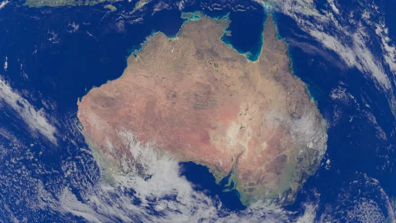
When most Australians open a mapping application and watch a blue dot settle onto their street, they reasonably assume the underlying technology is working as intended. In a general sense, it is. But the margin of error embedded in that dot — invisible to the casual user yet deeply consequential to industries that depend on centimetre-level precision — tells a more complicated story. Australia's position in the Southern Hemisphere is not merely a geographical footnote; it is a structural condition that shapes the quality of every GPS fix generated on this continent.
The Geometry Problem No One Talks About
GPS accuracy is not solely a function of how many satellites orbit the Earth. It depends heavily on where those satellites appear in the sky relative to the receiver on the ground — a concept geospatial scientists refer to as satellite geometry, formally measured by the Dilution of Precision (DOP) index. When satellites are clustered in one region of the sky rather than distributed evenly across the visible hemisphere, positional calculations become less reliable. Errors compound rather than cancel.
The United States' GPS constellation, along with Russia's GLONASS system, was designed and optimised with orbital inclinations that favour coverage across the mid-to-high latitudes of the Northern Hemisphere — where the majority of the world's population, military infrastructure, and economic activity were concentrated at the time of design. Australia, sitting between approximately 10° and 44° south latitude, receives satellite passes that are geometrically skewed toward the northern horizon. The practical result is that receivers in Sydney, Melbourne, or Perth regularly contend with satellite constellations that are less evenly spread across the sky dome than those experienced by users in London, Tokyo, or Los Angeles.
The difference in raw accuracy may be modest under ideal open-sky conditions — often a matter of a few metres. But in urban canyons, under dense canopy, or in the presence of atmospheric disturbance, that foundational disadvantage amplifies significantly.
Where the Gaps Become Dangerous
For the average commuter, a three-metre positional error means arriving at the correct building rather than the exact entrance. For an autonomous vehicle navigating a multi-lane motorway at 100 kilometres per hour, it can mean the difference between staying within a lane and crossing into the path of oncoming traffic.
Australia's autonomous vehicle sector, still in a relatively early but rapidly advancing phase, is encountering this reality directly. Trials conducted along corridors in South Australia and Western Australia have highlighted moments where satellite geometry degradation — particularly during periods of high ionospheric activity associated with the Southern Hemisphere's proximity to the auroral zone — produces positioning uncertainty that exceeds acceptable thresholds for autonomous decision-making. Engineers working on these programmes do not publicly characterise this as a crisis, but the mitigation strategies they employ — sensor fusion with LiDAR, inertial measurement units, and high-definition mapping overlays — are themselves an acknowledgement that GNSS alone is insufficient.
Emergency services face a different but equally serious dimension of the problem. When paramedics, firefighters, or search-and-rescue teams operate in peri-urban or regional environments where address databases are sparse and landmarks are few, GPS coordinates become the primary navigational reference. Accuracy degradation in these contexts is not an abstract technical concern — it translates to delayed response times. Geospatial researchers at several Australian institutions have documented cases in which ambiguous coordinate fixes have sent first responders to incorrect locations in rural shires, adding critical minutes to already stretched response windows.
The construction and civil engineering sectors present yet another dimension. High-precision GNSS receivers used for machine control on major infrastructure projects — road grading, pipeline alignment, foundation placement — rely on Real-Time Kinematic (RTK) corrections to achieve the centimetre-level accuracy that modern contracts demand. When the underlying satellite geometry is poor, RTK solutions take longer to initialise, are more susceptible to losing their fixed solution, and require more frequent recalibration. On large projects, this translates to measurable productivity losses and, in some cases, rework.
The Multi-Constellation Response
The geospatial industry's primary answer to the geometry problem is constellation diversity. Rather than relying exclusively on the American GPS system, modern multi-constellation receivers draw simultaneously on GLONASS, the European Union's Galileo system, and China's BeiDou Navigation Satellite System. Each constellation operates with a distinct set of orbital planes and satellite positions, meaning that when combined, the aggregate sky view available to an Australian receiver is substantially richer.
BeiDou is particularly significant in this context. Designed with a geostationary and inclined geosynchronous satellite component in addition to its medium Earth orbit satellites, BeiDou provides stronger coverage across the Asia-Pacific region — including Australia — than older Northern Hemisphere-centric systems. Independent testing conducted across multiple Australian urban and regional environments has demonstrated that multi-constellation receivers using BeiDou achieve meaningfully better DOP values and faster fix acquisition compared to GPS-only devices, particularly in the southern states.
Japan's Quasi-Zenith Satellite System (QZSS) extends its footprint across the Asia-Oceania region and provides both augmentation signals and additional ranging sources that benefit Australian receivers. While QZSS is not a full global constellation, its high-elevation satellite passes address one of the specific weaknesses of GPS geometry in Australia: the absence of high-angle satellites in the southern sky.
Geoscience Australia operates the Australian Regional GNSS Network (ARGN) and contributes to the Asia-Pacific Reference Frame (APREF), providing the infrastructure through which RTK and Precise Point Positioning (PPP) corrections are disseminated across the country. These ground-based augmentation layers are essential to bringing operational accuracy in line with what industries require, compensating through correction data for what satellite geometry alone cannot deliver.
Toward a More Spatially Equitable Future
It would be an overstatement to describe Australia as geospatially disadvantaged in absolute terms. The combination of multi-constellation receivers, augmentation networks, and sensor fusion technologies means that precision positioning is achievable across most of the continent for applications that invest in the appropriate infrastructure. What remains true, however, is that achieving equivalent accuracy to what Northern Hemisphere users obtain from simpler, cheaper equipment requires greater technical effort and greater financial investment in Australia.
This asymmetry has policy implications. As autonomous systems, smart infrastructure, and location-aware services become embedded in Australia's economic fabric, the baseline quality of positioning data underpins an expanding range of decisions. Ensuring that the nation's geospatial infrastructure keeps pace with that demand — through continued investment in augmentation networks, through advocacy for satellite constellation designs that serve Southern Hemisphere users equitably, and through rigorous public research into the real-world performance of positioning systems across Australian environments — is not a peripheral technical concern.
It is, increasingly, a matter of national infrastructure.
The blue dot on the screen may look the same wherever you are. The science underneath it is not.