Invisible on the Map: How Geospatial Gaps Are Locking Remote Australians Out of the Digital Economy
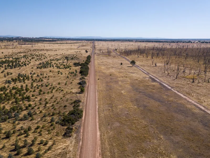
In the small outback township of Tibooburra, in far north-western New South Wales, a local nurse coordinator recently attempted to register her clinic for a telehealth platform. The system rejected the submission. The postcode existed in government records, but the precise geolocation data the platform required — street-level coordinates, verified address geometry — simply did not. For the platform's algorithm, Tibooburra was, in effect, nowhere.
This is not an isolated incident. Across remote and regional Australia, a quiet but consequential crisis is unfolding at the intersection of geography and digital infrastructure. Incomplete, inaccurate, or entirely absent GPS coverage is preventing communities from accessing services that urban Australians take for granted. The consequences extend far beyond inconvenience: they touch emergency response times, medical access, financial inclusion, and the basic ability to participate in a digital economy that increasingly demands a precise, verifiable location as the price of entry.
The Architecture of Absence
Australia's geospatial data ecosystem is, in many respects, sophisticated. Agencies such as Geoscience Australia maintain world-class datasets, and the national Geocoded National Address File (G-NAF) is widely regarded as a benchmark in address infrastructure. Yet coverage is not uniform, and the gap between metropolitan precision and remote approximation is significant.
In densely populated urban corridors, addresses are geocoded to sub-metre accuracy. Delivery platforms, emergency dispatch systems, and financial services can resolve a location to a specific dwelling within seconds. In remote areas, the same systems may return a coordinate placed at the centre of a postal district spanning hundreds of square kilometres — or return no result at all.
The reasons are partly technical. Satellite-based positioning systems function globally, but the utility of GPS data depends on the terrestrial infrastructure layered beneath it: the address databases, the road network geometries, the building footprints that transform a raw coordinate into a meaningful location. In areas where cadastral surveys are sparse, where roads are unnamed or unmapped, and where dwellings lack formal street addresses, that translation layer simply does not exist.
Bureaucratic fragmentation compounds the problem. Address data in Australia is managed across multiple jurisdictions — federal, state, and local — and standards are inconsistent. A property that exists in one dataset may be absent from another. For service providers relying on third-party geocoding APIs, these inconsistencies create dead zones that are invisible until someone, somewhere, needs to be found.
When Location Becomes a Lifeline
The stakes become starkly apparent in emergency response. Ambulance and fire services across Queensland, Western Australia, and the Northern Territory have long grappled with the challenge of locating callers in areas where street addresses are unreliable or nonexistent. A triple-zero call placed from a remote station may yield a GPS coordinate from the caller's mobile device, but if that coordinate cannot be resolved to a dispatched vehicle's navigation system, precious minutes are lost.
Research conducted in collaboration with emergency management agencies has shown that location ambiguity in remote areas can add anywhere from eight to twenty-five minutes to response times — a margin that, in cardiac or trauma cases, is frequently the difference between survival and death.
Telehealth presents a parallel challenge. The expansion of remote medical services accelerated significantly during the COVID-19 pandemic, and platforms that once served primarily urban patients were rapidly scaled to reach rural and remote communities. Many of these platforms, however, use location verification as a compliance mechanism — confirming that a patient is who and where they claim to be. When location data is absent or imprecise, the verification fails, and patients are denied access.
Financial services present yet another dimension. Open banking platforms, digital lenders, and even some government payment systems use geolocation as part of identity and fraud-prevention protocols. For individuals in communities with poor geospatial data, this creates a paradox: the very people most likely to lack access to traditional banking infrastructure are also the most likely to be excluded from the digital alternatives designed to serve them.
The Last-Mile Problem, Compounded
The logistics sector offers perhaps the most visible illustration of geospatial exclusion. E-commerce has transformed retail access for Australians in major cities, but the promise of next-day delivery dissolves rapidly beyond the urban fringe. Delivery companies rely on geocoded address data to route vehicles efficiently, and in areas where that data is absent or unreliable, the economic calculus shifts: delivery becomes too costly, too uncertain, or simply impossible.
For communities in remote Western Australia or the Gulf Country of Queensland, this means that access to goods — including pharmaceuticals, medical supplies, and agricultural inputs — remains dependent on infrequent mail runs or costly private freight arrangements. The digital economy's promise of democratised access has, in practice, reinforced existing geographic inequalities.
Emerging Responses: Technology and Policy
There is, however, reason for cautious optimism. A number of initiatives are beginning to address the structural gaps.
Geoscience Australia's Location Index (LocI) project has worked to create a linked data framework that reconciles address information across jurisdictions, improving the consistency and coverage of location data in underserved areas. Meanwhile, state governments including Queensland and South Australia have invested in expanding rural addressing programs, assigning formal coordinates to previously unregistered properties and integrating these into emergency dispatch systems.
In the private sector, companies developing what3words-style alternative addressing systems have gained traction in remote communities, offering a mechanism for communicating precise locations without reliance on formal address infrastructure. While these systems are not a substitute for comprehensive geospatial reform, they provide an interim solution that has demonstrably improved emergency response outcomes in pilot regions.
Satellite connectivity, particularly through low-Earth orbit networks such as Starlink, is also reshaping the equation. As connectivity improves in remote areas, the demand for accurate geospatial data will increase — and the pressure on government and industry to supply it will grow accordingly.
Towards Spatial Equity
The concept of spatial equity — the idea that access to geospatial infrastructure should not be determined by postcode — is gaining currency in Australian policy discussions. Advocates argue that geospatial data should be treated as public infrastructure, subject to the same universal service obligations that govern telecommunications and road networks.
This framing has implications for how investment decisions are made. If location data is understood as infrastructure rather than a commercial product, the case for public funding of remote geocoding programs becomes considerably stronger.
For the communities living with the consequences of geospatial invisibility, the argument is not abstract. It is a matter of being seen — of existing, in the eyes of the systems that increasingly govern access to services, opportunity, and safety. Getting that right is not merely a technical challenge. It is a question of equity, and one that Australia's geospatial community has both the tools and the responsibility to address.