The City Seen From Your Pocket: How Smartphone Location Data Is Quietly Transforming Australian Urban Planning
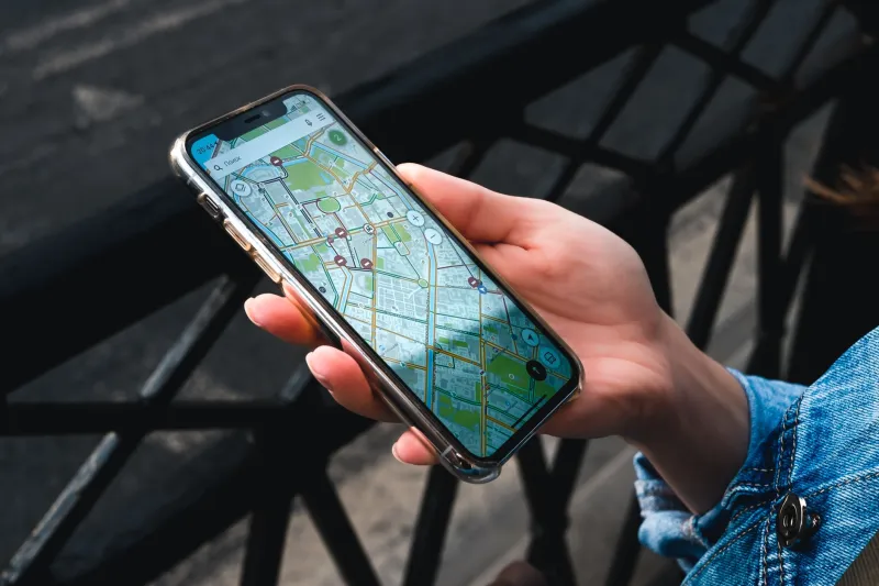
There is a version of urban planning that relies on surveys, traffic counts, and carefully constructed models built from data that is, at best, a few years out of date. It is a discipline that has always been asked to make confident predictions about human behaviour using incomplete information. For most of the twentieth century, that was simply the nature of the work.
That version of urban planning is rapidly becoming obsolete.
Today, the movements of millions of Australians through their cities and towns are being recorded, aggregated, and analysed in near real-time — not by government surveillance apparatus, but by the GPS chips embedded in the smartphones most of us carry as a matter of daily routine. When that data is appropriately anonymised and processed at scale, it generates a picture of how cities actually function that no survey instrument has ever been able to produce. And Australian planning authorities, transport agencies, and local councils are increasingly learning how to read that picture.
This development deserves serious and sustained public attention — both for the genuine innovation it enables and for the risks it introduces.
What the Data Actually Shows
To understand why location intelligence derived from smartphone GPS signals is so valuable to urban planners, it helps to consider what conventional data collection cannot tell us. Origin-destination surveys, for instance, ask a sample of residents where they travel, how often, and by what mode. They are expensive, infrequent, and inherently limited by the willingness of respondents to participate and the accuracy of their self-reporting.
Aggregated, anonymised GPS mobility data sidesteps these limitations almost entirely. When processed through the analytical frameworks that companies like Google, HERE Technologies, and several Australian-based geospatial firms now offer to government clients, smartphone location data can reveal, with considerable precision, the actual movement patterns of large populations. It can identify which bus stops are used as genuine boarding points and which are bypassed in favour of alternatives two streets away. It can map the pedestrian desire lines that cut across parks and vacant lots — the informal paths that people actually walk, as opposed to the formal footpaths planners assumed they would use.
It can also expose the failure modes of existing infrastructure in ways that no model predicted. During the extended construction disruptions on Melbourne's Anzac Station project, for example, mobility data provided transport planners with real-time evidence of how commuters were adapting — which alternative routes were absorbing displaced demand, and where the secondary network was approaching capacity. That kind of granular, current intelligence would previously have taken months to assemble from conventional sources.
Monash Researchers and the Ethics of Location Intelligence
At Monash University, geospatial researchers working at the intersection of spatial data science and urban analytics have been examining both the technical possibilities and the ethical boundaries of this field. Their position — and it is one I find persuasive — is that the value of aggregated mobility data for public planning purposes is real and substantial, but that it cannot be pursued without a robust framework governing consent, anonymisation standards, and the purposes for which data may be used.
This is not a fringe concern. The distinction between genuinely anonymised aggregate data and data that can be re-identified through spatial correlation is technically non-trivial. A dataset that records, in aggregate, the number of people who moved between Parramatta and Chatswood on a Tuesday morning may be entirely benign. A dataset that records the movement of a specific device from a residential address to a medical facility and back — even without a name attached — begins to raise legitimate questions about individual privacy.
Monash researchers have argued for a tiered approach to the governance of location intelligence in Australian public planning contexts. At the broadest level, highly aggregated, temporally smoothed mobility statistics present minimal privacy risk and offer substantial planning value — and their use should be encouraged and formalised through appropriate regulatory frameworks. At finer levels of granularity, however, much stricter controls are warranted, including independent ethical review, mandatory sunset clauses on data retention, and genuine transparency with the public about what data is being used and why.
The Planning Gains Are Real
It would be intellectually dishonest to frame this discussion as though the benefits of smartphone GPS data for urban planning were speculative or marginal. They are not.
In South East Queensland, transport planners have used mobility analytics to redesign several underperforming bus corridors, rerouting services to align more closely with the movement patterns revealed by location data rather than with the historical routes inherited from a very different urban geography. Early assessments suggest meaningful improvements in patronage on the redesigned corridors.
In metropolitan Sydney, the NSW Department of Planning has incorporated mobility data into its evidence base for several strategic planning documents, using movement patterns to identify locations where mixed-use zoning changes might reduce car dependency by placing more residents within walkable distance of destinations they already frequent.
In Perth, local councils have used pedestrian flow data derived from anonymised location signals to prioritise footpath upgrades and crossing improvements — directing limited capital budgets toward the junctions that data confirms are heavily used, rather than those that planners assumed would be.
These are not hypothetical use cases. They are happening now, and they are producing better planning outcomes than would otherwise have been achievable.
The Consent Question We Have Not Answered
And yet, there is a conversation Australian society has not yet had — not properly, at any rate.
Most Australians who share location data with their smartphones do so through the terms-of-service agreements of applications they have downloaded, agreements that few people read in full and fewer still genuinely understand. The downstream use of that data — its sale to analytics aggregators, its eventual incorporation into government planning processes — is typically disclosed in language that is technically accurate but practically opaque.
This is not a satisfactory basis for a social contract around data that is, in aggregate, shaping the physical form of Australian cities. The fact that the data is anonymised before it reaches planners does not resolve the underlying question of whether the people who generated it have meaningfully consented to its use for these purposes.
Geospatial researchers at Monash have proposed that Australian governments consider a positive consent framework for the use of mobility data in public planning — one that goes beyond the passive opt-out mechanisms currently embedded in smartphone operating systems and instead creates clear, accessible channels through which citizens can understand and influence how their movement data contributes to public decision-making.
This would require legislative action. It would also require a level of public communication about location intelligence that Australian governments have not yet undertaken. But it is the right direction.
A Technology Worth Getting Right
The GPS revolution that is reshaping Australian urban planning is not going to reverse itself. The data exists, the analytical tools exist, and the planning benefits are sufficiently compelling that no jurisdiction is going to voluntarily set them aside. Nor should they.
What Australian society can and should demand, however, is that this revolution be conducted transparently, governed rigorously, and oriented consistently toward the public interest. The smartphone in your pocket is generating data that is quietly redesigning the city around you. That is a remarkable thing — and it deserves to be treated with the seriousness it warrants.