Mapping Country: When Aboriginal Spatial Knowledge and Satellite Technology Walk Together
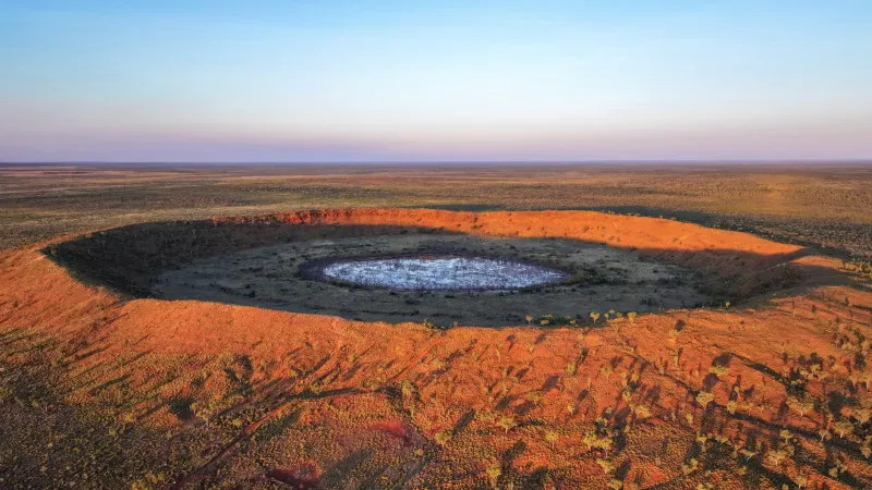
For tens of thousands of years, Aboriginal Australians navigated vast, often unforgiving landscapes without a single satellite overhead. They read the land through story, ceremony, seasonal pattern, and intimate ecological observation — a form of spatial intelligence so sophisticated that it guided entire communities across deserts, wetlands, and coastal country with extraordinary precision.
Today, a new kind of collaboration is underway. Researchers at Monash University are working alongside Indigenous communities in remote Australia to ask a question that is as practical as it is philosophical: what happens when you place that ancient intelligence in dialogue with the most advanced location technologies available?
The answer, emerging from several years of fieldwork and co-design, is proving to be far more than a technical exercise.
Two Systems of Knowing Country
Conventional GPS and geospatial mapping systems are extraordinarily powerful tools. They can pinpoint a location to within centimetres, track the movement of livestock across thousands of hectares, and generate three-dimensional models of terrain from satellite imagery alone. Yet for all their precision, these systems were designed without reference to the relational and dynamic ways in which Indigenous Australians understand land.
Traditional ecological knowledge — often abbreviated as TEK in academic literature — encompasses not only the physical features of a landscape but also its seasonal rhythms, the behaviour of its flora and fauna, and the cultural obligations that govern how land is managed and traversed. This knowledge is spatial in nature, but it does not map neatly onto a coordinate grid.
Monash geospatial scientists have been working to bridge this gap, developing methodologies that allow traditional knowledge holders to contribute spatial data in ways that reflect, rather than flatten, the complexity of their understanding. The approach draws on participatory mapping techniques, where Elders and rangers guide the documentation of culturally significant sites, land management boundaries, and ecological indicators — information that is then integrated with satellite-derived datasets.
From the Spinifex to the Screen
In practice, the collaboration looks quite different from a standard geospatial research project. Rather than arriving with pre-designed data collection frameworks, Monash researchers have spent considerable time on country with Indigenous land managers, listening before mapping.
One of the most significant outcomes of this approach has been the development of what the team refers to as culturally-informed spatial layers — additional data fields within mapping systems that capture not just the physical location of a feature, but its cultural status, seasonal accessibility, and management history as defined by traditional custodians.
For Aboriginal ranger programmes operating across the Northern Territory and parts of Western Australia, this has had immediate practical value. Rangers using GPS-enabled devices in the field can now access maps that reflect both satellite data and community-held knowledge, allowing them to make more informed decisions about fire management, feral animal control, and weed suppression.
The integration also works in the other direction. Traditional knowledge holders are using spatial data to monitor changes in country over time — comparing current satellite imagery against oral accounts of how a waterhole or woodland appeared decades ago. In several cases, this has identified environmental changes that would not have been flagged by remote sensing alone.
The Challenge of Data Sovereignty
One of the most complex dimensions of this work concerns who owns the spatial data that is generated. Indigenous communities have long-standing and legitimate concerns about the extraction of knowledge — cultural, ecological, or otherwise — by outside institutions. Geospatial data is no exception.
Monash's approach has placed data sovereignty at the centre of its partnership agreements. Communities retain ownership and control over culturally sensitive spatial layers, with tiered access protocols that determine what information can be shared publicly, what is available only to authorised researchers, and what remains entirely within community custody.
This framework draws on principles developed by the Global Indigenous Data Alliance and has been adapted in consultation with each partner community. It represents a meaningful departure from earlier models of academic research in remote Australia, where data collected from Indigenous lands frequently left those communities with little lasting benefit or control.
The technical infrastructure supporting this approach — including locally hosted servers and offline-capable mapping applications — has been developed with connectivity limitations in mind. Many of the communities involved have unreliable or expensive internet access, and the tools must function effectively in low-bandwidth environments.
Redefining Precision
There is a tendency within geospatial science to equate precision with quantitative exactness — the smaller the margin of error, the more useful the data. But the Monash research team has come to understand precision differently through this work.
A map that accurately records the GPS coordinates of a sacred site but fails to capture the cultural protocols governing its use is, in a meaningful sense, imprecise. It omits information that is essential to understanding that location correctly. Conversely, a map that integrates traditional knowledge alongside satellite data may carry uncertainty in some of its coordinates but convey a far richer and more actionable understanding of the landscape.
This reframing has broader implications for how geospatial science approaches Indigenous land management across Australia. With more than 50 per cent of the Australian continent under some form of Indigenous land tenure or management agreement, the scale of potential application is substantial.
Looking Ahead
The Monash team is currently working to develop open-source tools that other research institutions and Indigenous organisations can adapt for their own contexts. A forthcoming technical framework, developed in partnership with several Northern Territory land councils, will outline protocols for integrating traditional ecological knowledge into standard GIS platforms — including QGIS and ArcGIS — without requiring communities to surrender control of sensitive information.
There is also growing interest from state and federal government agencies responsible for environmental monitoring and emergency management. Bushfire response, in particular, stands to benefit significantly from maps that combine real-time satellite data with community knowledge of historical fire behaviour and culturally important areas that require protection.
What this work ultimately demonstrates is that the future of geospatial science in Australia is not a story of technology replacing traditional knowledge, nor of tradition resisting technological change. It is a story of two sophisticated spatial intelligence systems finding, with care and patience, a common language.
For the communities involved, that language is not merely academic. It is a means of asserting presence, protecting country, and ensuring that the land continues to be understood on its own terms.