Beneath the Surface: How 3D Geospatial Mapping Is Redefining Australia's Underground Infrastructure
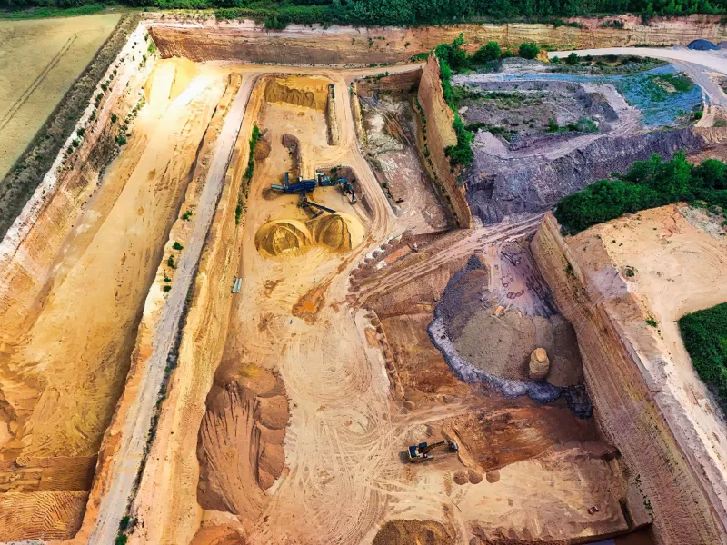
In 2021, a routine gas pipeline extension in suburban Melbourne was halted for eleven days after excavation crews struck an uncharted stormwater main. The delay cost the project's contractors an estimated $340,000 and required the emergency relocation of residents from four properties while repairs were undertaken. The pipe in question appeared on no current utility map. It had been laid in the 1960s, recorded on paper plans that were never digitised, and forgotten.
Incidents of this nature occur across Australia with disquieting regularity. The nation's urban and peri-urban environments sit atop a dense, poorly documented stratigraphy of infrastructure laid across more than a century of development — water mains, gas lines, telecommunications conduit, electrical cabling, stormwater and sewerage networks — much of it recorded in formats that bear little relationship to the precision demanded by contemporary construction and planning.
The emergence of GPS-integrated subsurface mapping technologies is beginning to offer a credible response to this challenge. Ground-penetrating radar (GPR), electromagnetic induction sensors, and multi-beam sonar systems, when combined with precise geospatial positioning and three-dimensional visualisation platforms, are enabling engineers and planners to see underground with a clarity that was, until recently, unimaginable.
The Limits of Legacy Documentation
The problem of subsurface uncertainty is, at its core, a data problem — and one with deep historical roots. Australian infrastructure development across the twentieth century was largely administered by separate authorities operating in parallel: water boards, gas utilities, telecommunications carriers, and local councils each maintained their own records, in their own formats, with their own coordinate systems. Integration was rare; standardisation was rarer still.
The transition to digital record-keeping, which accelerated from the 1980s onwards, did not resolve the underlying fragmentation. Legacy paper plans were digitised inconsistently, with positional errors introduced during the conversion process. Assets installed before the digital era were frequently omitted entirely. And in rapidly developing areas, the pace of construction often outstripped the capacity of asset registers to keep pace.
The result is a subsurface data environment characterised by gaps, inconsistencies, and errors that have real and costly consequences. Safe Work Australia estimates that underground utility strikes account for a significant proportion of serious excavation incidents each year, with economic costs running into the hundreds of millions of dollars nationally when project delays, emergency repairs, and service disruptions are aggregated.
Ground-Penetrating Radar Meets Geospatial Precision
Ground-penetrating radar has existed as a technology for several decades, but its utility in infrastructure planning was historically constrained by limitations in both the resolution of the radar signal and the accuracy of the positional data attached to survey results. A GPR return indicating a buried object at approximately three metres' depth, located somewhere within a ten-metre horizontal radius, is of limited value to an excavation crew working with a machine that can remove a metre of soil in a single pass.
The integration of high-accuracy GPS positioning — and, increasingly, real-time kinematic (RTK) correction systems capable of achieving centimetre-level accuracy — has transformed the practical utility of subsurface sensing. When GPR data is georeferenced with precision, the resulting dataset can be imported directly into building information modelling (BIM) platforms and geographic information systems (GIS), producing three-dimensional subsurface models that engineers can interrogate, analyse, and incorporate into design workflows.
In Australia, this approach is being applied across a range of sectors. Infrastructure NSW has piloted integrated GPR-GPS survey programs in advance of major urban renewal projects in Sydney, producing subsurface utility models that have been credited with reducing unexpected utility strikes on participating projects by more than sixty per cent. Similar programs are underway in South East Queensland, where rapid population growth is placing sustained pressure on ageing infrastructure networks.
Mining and the Subsurface Frontier
Australia's resources sector presents a distinct but equally compelling application context. Underground mining operations depend on precise knowledge of subsurface geology, existing tunnel networks, and the location of buried services — and errors in any of these domains carry consequences that extend well beyond financial cost.
Advanced geospatial mapping technologies are increasingly integrated into mine planning workflows, enabling operators to construct detailed three-dimensional models of ore bodies, fault structures, and existing excavations. GPS positioning systems, adapted for use in GPS-denied underground environments through the use of inertial navigation and ultra-wideband radio positioning, allow survey data to be collected continuously as mining equipment moves through the orebody, updating the geological model in near-real time.
Companies operating in the Pilbara and the Olympic Dam region have reported measurable improvements in resource recovery rates attributable to more precise subsurface mapping — a finding with direct implications for both profitability and the environmental footprint of extraction operations. By understanding the geometry of an orebody with greater fidelity, operators can reduce the volume of waste rock moved and the extent of surface disturbance required to access a given quantity of mineral resource.
Protecting What Cannot Be Replaced
The application of subsurface geospatial technology to cultural heritage protection represents perhaps the most ethically significant dimension of this field. Australia's archaeological record — both Indigenous and post-contact — is extensive, incompletely documented, and highly vulnerable to disturbance during infrastructure development.
Traditional archaeological survey methods are effective but inherently destructive: the act of excavating a site to determine what it contains necessarily alters or damages the evidence being sought. Non-invasive geophysical survey techniques, including GPR, magnetometry, and electrical resistivity tomography, offer the prospect of characterising subsurface archaeological features without disturbing them.
In Western Australia, collaborative projects involving Monash-affiliated researchers and local Aboriginal communities have used GPR and LiDAR-derived digital elevation models to identify and map subsurface cultural features across pastoral properties slated for development. The resulting datasets have informed both heritage protection decisions and the design of infrastructure corridors that avoid areas of cultural significance — a practical demonstration of how geospatial technology can serve as a tool for cultural stewardship rather than merely commercial efficiency.
Similar approaches are being explored in advance of major infrastructure projects along the eastern seaboard, where colonial-era archaeological remains are routinely encountered during urban redevelopment. The ability to characterise subsurface heritage non-invasively before excavation commences allows heritage managers to make informed decisions about significance and protection without the time and cost pressures that typically accompany unexpected discoveries during construction.
Towards a National Subsurface Data Framework
The full potential of subsurface geospatial mapping will not be realised through technology alone. The data produced by GPR surveys, utility locating programs, and archaeological investigations is currently distributed across hundreds of asset owners, government agencies, and consulting firms, with limited mechanisms for aggregation, standardisation, or sharing.
Advocates within the geospatial and infrastructure planning communities have called for the establishment of a national subsurface data framework — a federated system that would allow subsurface information to be captured, stored, and accessed in a consistent format across jurisdictions. Such a framework would not require the centralisation of sensitive commercial or security data, but would establish the common standards and interfaces necessary to make disparate datasets interoperable.
The economic case is substantial. Modelling conducted for Infrastructure Australia has suggested that a well-designed national subsurface data platform could reduce the cost of underground utility damage across the construction sector by more than $1.2 billion annually. The environmental and heritage protection benefits, while harder to quantify, are no less significant.
What lies beneath Australia's surface is, in many respects, as complex and consequential as what sits above it. The geospatial tools now available to map that hidden world are more powerful than at any point in history. The challenge — and the opportunity — lies in deploying them systematically, collaboratively, and with the ambition the problem demands.