What Old Coordinates Tell Us: Mining Australia's GPS Archives for Structural Truth

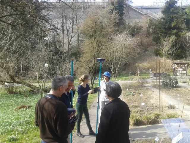
Photo: infrastructure monitoring GPS sensors bridge dam structural survey Australia, via i.pinimg.com
In the mid-2000s, a network of GPS sensors was installed across a major Australian port facility as part of a routine infrastructure monitoring programme. The sensors were not cutting-edge; they were standard survey-grade receivers logging positional data at regular intervals, feeding into a database that was reviewed periodically and otherwise left to accumulate. Nobody at the time described it as building an archive. It was simply data collection—a precaution, a compliance requirement, a background hum.
Today, that data is among the most valuable geospatial records the facility possesses. Because when engineers began noticing anomalies in the port's wharf geometry—subtle misalignments in crane rail spacing, gradual changes in the drainage gradient of loading aprons—they needed a baseline against which to measure the present. The GPS records, stretching back nearly two decades, provided exactly that. They revealed not a sudden structural event but a slow, continuous subsidence: millimetres per year, compounding silently over time, now amounting to a displacement significant enough to require remediation.
The archive had been speaking for years. The facility had simply not had reason to listen until the consequences of not listening became visible.
The Accumulating Value of Positional Records
GPS data ages differently from most infrastructure records. An engineering drawing becomes less useful as a structure is modified over time. A maintenance log is valuable only if it captures what was done. But a continuous GPS position record becomes more valuable with time, not less—because it captures not just the state of a structure at a moment, but the trajectory of change across years and decades.
This is the foundational insight driving a growing field of infrastructure monitoring that sits at the intersection of geodesy, structural engineering, and data science. Researchers at Monash University's geospatial research programmes have been examining the potential of legacy GPS datasets—records collected for purposes that are now complete or obsolete—to serve as historical benchmarks for infrastructure assessment.
The methodology is not complicated in principle. Take a structure for which GPS monitoring data exists from a decade or more ago. Collect fresh observations at the same points using equivalent or superior equipment. Compare the two datasets after accounting for datum shifts, antenna reference point changes, and other technical sources of discrepancy. What remains is the structural signal: movement, settlement, or deformation that has occurred in the intervening period.
The complication is that legacy datasets were rarely collected with future reanalysis in mind. Metadata is often incomplete. Antenna models are not always recorded. Reference frame versions are inconsistently documented. Extracting a reliable structural signal from imperfect archival data requires considerable geodetic expertise—but the effort is increasingly justified by the insights it yields.
Dams Under the Long View
Australia's major dam network is ageing. Many of the country's largest storage facilities were constructed in the mid-twentieth century and are now approaching or exceeding their original design lives. Structural assessment of dam infrastructure is a well-established discipline, but it has historically relied on periodic physical inspection and in-situ instrumentation rather than satellite positioning data.
That is changing. Several of Australia's state water authorities have been quietly revisiting GPS datasets collected during dam safety monitoring programmes in the 2000s and early 2010s, comparing them against current observations to detect long-term movement trends that shorter observation windows would miss.
At one major storage facility in south-eastern Australia—the specific location withheld pending completion of a formal assessment—this reanalysis revealed a pattern of crest movement consistent with slow foundation consolidation in one abutment zone. The movement rate, approximately 2–3 millimetres per year, was within the tolerance range that had been considered acceptable at the time of original monitoring. Viewed across fifteen years of accumulated data, however, the cumulative displacement told a more complex story—one that has now informed a targeted geotechnical investigation.
The GPS archive did not diagnose the problem. It identified the question that needed to be asked.
Bridges and the Geometry of Time
Long-span bridges present a particularly rich case for historical GPS analysis. Their structural behaviour is dynamic—they flex, thermally expand, and respond to traffic loading in ways that are well understood in the short term. What is less well understood is how the baseline geometry of a bridge changes over years and decades, as bearings wear, foundations settle unevenly, and post-tensioning losses accumulate.
The West Gate Bridge in Melbourne and the Sydney Harbour Bridge are among the structures for which multi-decade GPS records now exist in various forms—some from dedicated monitoring programmes, others from survey campaigns conducted for unrelated purposes. Researchers have begun exploring whether these records, combined with modern high-precision GNSS observations, can reveal long-term geometric drift that conventional inspection methods might not detect until it manifests as a visible defect.
The challenge is methodological rigour. Comparing observations made with different equipment, under different atmospheric conditions, processed with different software versions, requires careful normalisation. The International GNSS Service's archive of reference station data provides a critical external check—allowing historical observations to be reprocessed against a consistent global reference frame rather than the local datum conventions that were current at the time of original collection.
The Port Subsidence Problem
Australia's major port facilities sit on some of the country's most geologically variable ground. Port of Brisbane occupies reclaimed land in a tidal estuary. Port Botany is built on Holocene sediments overlying Hawkesbury sandstone. Port of Melbourne straddles the confluence of the Yarra and Maribyrnong rivers, in an area with a long history of differential settlement.
All of these environments are susceptible to ongoing ground movement—compaction of fill materials, consolidation of soft sediments, and in some coastal areas, the slow contribution of sea-level rise to effective land elevation loss. GPS monitoring provides a direct measurement of these movements, but only if observations are made consistently enough, and over a long enough period, to distinguish real structural signal from measurement noise.
The port sector in Australia has been among the more systematic adopters of continuous GPS monitoring, partly because the consequences of structural failure are so immediately visible in operational terms—a wharf that has settled unevenly cannot safely accommodate the crane rail tolerances required by modern container handling equipment. The data accumulated through these monitoring programmes is now, in many cases, old enough to be genuinely revealing.
Building the Archive Habit
The lesson that emerges from these case studies is straightforward, if not always acted upon: GPS data collected today is infrastructure data for the future. Every continuous monitoring installation, every periodic survey campaign, every reference station observation is contributing to an archive that will become more valuable as time passes—provided it is stored in a form that remains interpretable.
This requires discipline around metadata. The antenna type, the receiver firmware version, the reference frame in use, the processing software and its settings: all of these must be recorded alongside the coordinates themselves. Without this context, future analysts will face the same challenge as an archaeologist confronted with an artefact that has been removed from its stratigraphic layer—the object exists, but its meaning is diminished by the loss of context.
Geoscience Australia's national geodetic infrastructure provides a framework within which this archival discipline can be anchored. The network of continuously operating reference stations, with its long and well-documented observation history, offers the stable reference against which future reanalysis of legacy datasets can be conducted. The investment in maintaining and extending that network is, among other things, an investment in the interpretability of every GPS observation collected across Australia today.
The coordinates being logged right now are tomorrow's baseline. The question is whether we will have the foresight to treat them accordingly.