Fragmented Signals: The Battle for RTK Correction Dominance Is Costing Australian Industry More Than Anyone Admits
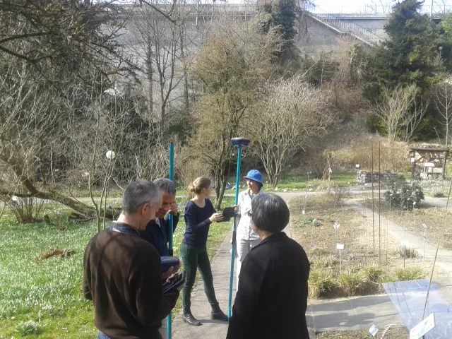
Photo: North Surveying, CC BY-SA 4.0, via Wikimedia Commons
The promise of real-time kinematic positioning is straightforward: take a standard GNSS receiver, feed it a correction stream derived from a nearby ground reference station, and compress its positional uncertainty from metres down to centimetres or better. In practice, this promise is delivered across Australia through a network of competing services, operated by a mix of government agencies, private companies, and equipment manufacturers, each using slightly different standards, coverage models, and commercial arrangements. The result is a correction market that is, depending on one's vantage point, either vibrantly competitive or quietly chaotic.
The Architecture of a Fragmented Market
RTK corrections in Australia are delivered through continuously operating reference station (CORS) networks — arrays of precisely surveyed GNSS receivers that compute and broadcast the difference between observed and expected satellite signals. That difference, the correction, is transmitted to field receivers via mobile data, radio, or satellite link, enabling the centimetre-level accuracy that precision agriculture, machine control, and cadastral surveying now depend upon.
The CORS landscape in Australia is layered. At the national level, Geoscience Australia operates the Australian Regional GNSS Network (ARGN), a sparse network of high-quality reference stations whose primary purpose is geodetic research and datum maintenance rather than real-time correction delivery. At the state level, agencies such as Spatial Services NSW, Land Use Victoria, and Landgate in Western Australia have established denser networks — the CORSnet-NSW, GPSnet, and SBAS networks respectively — oriented toward practical industry use. Alongside these public networks, private operators including Leica Geosystems, Trimble, Hexagon, and a growing cohort of independent correction service providers have built their own infrastructure, offering varying coverage densities and subscription models.
The agricultural sector has been a particularly significant driver of private network investment. As precision agriculture adoption accelerated through the 2010s, equipment manufacturers recognised that bundling correction access with machinery purchases created both a revenue stream and a competitive moat. The consequence is that a farmer in the Riverina operating a Trimble-equipped tractor and a neighbouring grower using a Leica-equipped machine may be drawing corrections from entirely different networks, using incompatible formats, with no interoperability between them.
Standards and the Absence Thereof
The technical foundation of RTK correction delivery is not without standardisation. The Radio Technical Commission for Maritime Services (RTCM) has published correction message formats — most notably RTCM 3.x — that are nominally supported across the industry. In practice, the proliferation of proprietary extensions, manufacturer-specific optimisations, and competing network transmission protocols means that nominal compatibility frequently does not translate into operational interoperability.
The State Reference Network (SRN) operated in Queensland, for instance, has historically used transmission standards and datum realisations that require configuration adjustments when integrating with some private network corrections. Users operating across state boundaries — a common scenario in broadacre agriculture and long-distance infrastructure projects — must manage the transition between different correction environments, with the attendant risk of positioning discontinuities at network boundaries.
The Geocentric Datum of Australia 2020 (GDA2020) transition has added a further layer of complexity. Not all correction networks have completed the migration from GDA94, and the coexistence of both datum realisations in active use creates the possibility of systematic positional offsets when correction data and receiver configurations are not aligned. For applications where centimetre-level accuracy is the operational baseline, a datum mismatch of even a few centimetres can have material consequences.
The Coverage Gap and Its Costs
Beyond the standards question, the geographic distribution of correction network coverage reflects a persistent urban-rural imbalance. State government CORS networks are densest in coastal population centres and established agricultural zones. As users move into more remote operating environments — the pastoral stations of outback Queensland, the mining corridors of the Pilbara, the forestry operations of Tasmania's west coast — correction availability diminishes and positional accuracy degrades accordingly.
For precision agriculture, this gap is consequential. Variable-rate application systems, autonomous guidance, and yield mapping all depend on consistent correction quality across the full extent of a farming operation. A paddock that sits at the fringe of a correction network's effective range may receive corrections of insufficient quality to support centimetre-level guidance, forcing operators to either accept degraded performance or invest in supplementary infrastructure — private base stations, local CORS nodes — to fill the gap.
The cost of this infrastructure duplication is not trivial. Agronomists and precision agriculture consultants working in regional New South Wales and South Australia have reported that the per-farm cost of establishing private correction infrastructure to compensate for public network gaps runs into tens of thousands of dollars, a barrier that disproportionately affects smaller operations.
Private Capital and the Network Race
The private sector's response to public network limitations has been vigorous. In recent years, several well-capitalised correction service providers have moved aggressively to expand their Australian CORS footprints, acquiring or establishing reference stations in underserved regions and promoting subscription-based access models as an alternative to both public networks and private base station ownership.
This investment is commercially rational but does not resolve the fragmentation problem. Each new private network represents an additional layer in an already complex ecosystem. The emergence of network RTK (NRTK) services, which synthesise corrections from multiple reference stations to extend effective coverage and improve accuracy, has improved the user experience in many areas but has not addressed the fundamental interoperability deficit between competing providers.
The Satellite-Based Augmentation System (SBAS) trial conducted by Geoscience Australia and the Department of Transport between 2017 and 2019 demonstrated the potential of a nationally consistent, publicly available correction service delivered via geostationary satellite. The trial achieved sub-decimetre accuracy across much of the Australian continent without requiring cellular connectivity — a significant advantage in remote operating environments. The path from trial to permanent operational service has, however, been protracted, and the correction quality delivered by SBAS falls short of the centimetre-level standard required for the most demanding applications.
Toward a Coherent Framework
The argument for a more coherent national approach to RTK correction delivery does not require dismissing the role of private investment. It does require acknowledging that the current market structure imposes costs — in duplicated infrastructure, incompatible standards, and uneven coverage — that are borne by the industries relying on high-accuracy positioning rather than by the correction providers themselves.
A national correction infrastructure framework that established minimum coverage standards, mandated interoperable data formats, and created clear roles for public and private network operators would not eliminate commercial competition. It would, however, create the conditions under which that competition could deliver genuine value rather than merely redistributing the costs of fragmentation. Geoscience Australia, as the custodian of Australia's geodetic infrastructure, is the logical convener of such a framework, but its realisation would require coordinated commitment from state spatial agencies, industry bodies, and the correction service providers themselves.
The centimetre-level positioning capability that Australian industry depends upon is only as reliable as the correction infrastructure that enables it. That infrastructure, in its current form, is functional but fragmented — a patchwork of competing networks whose collective coverage and consistency falls short of what the economy it serves genuinely requires.